 Alker Aviation
Drone thermography – buildings and solar panels
A thermal camera on a drone records temperature differences on visible surfaces of buildings and solar arrays. Infrared images can be paired with RGB photographs to locate observations and plan further investigation.
What do we capture?
Thermography records surface thermal radiation. Patterns on buildings may indicate heat loss or thermal bridges. Reflections, material emissivity, weather and indoor-to-outdoor temperature differences affect interpretation. A bright area alone does not prove a building defect.
How can the data be used?
IR images of façades and roofs can help prioritise energy surveys and building investigations. Hotspots on solar arrays may identify modules or cells for closer inspection. Irradiance, wind and electrical load affect results. Thermography does not replace electrical testing or investigation of concealed structures.
What can we document?
- Heat loss and heat leakage in façades, roofs and windows
- Thermal bridges around floor joists, balconies and window frames
- Air leakage and draughts at junctions, doors and eaves
- Possible damp areas and insulation gaps that call for closer investigation
- Hotspots, faulty cells and bypass diodes in solar panels
- Warm junction boxes, deviating strings and soiling on PV modules
- Snow-melt patterns and heat escaping through roofs
- Energy surveys before and after added insulation or window replacement
Drone images show visible signs. Causes, extent and remedies must be assessed by a relevant specialist.
Deliverables and models
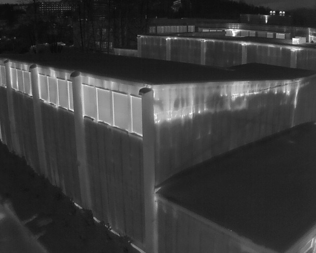
Deliverables may include an agreed set of IR and RGB images and a summary of observed temperature anomalies. Capture conditions, purpose and reporting scope are agreed before the flight. Original files are delivered privately through the customer portal; the image below is a public preview of a building façade.
Images and examples